


Smartphones are becoming the go-to device for global navigation, surpassing even the most advanced satellite navigation systems. Even though many modern automobiles come equipped with a satellite navigation system, most of us still rely on our trusty mobile phones to get us where we need to go. You should think carefully about which of the many accessible navigation applications in 2022 is worth the space on your phone.
To choose the best navigation app for your needs, go through our list of the top 10 options. We not only provide you the most up-to-date information on where to go, but we also recommend the best navigation applications to save you time and energy. In spite of how disoriented you may feel right now, these applications will have you headed in the correct way in no time.
Apple Maps
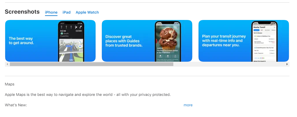
After a bumpy introduction with iOS 6 in 2012, Apple refined its Maps app till it rivalled Google Maps on iOS devices. It’s free and instantly available because it’s part of iOS. The app’s easy user interface gives turn-by-turn spoken directions to vehicles, pedestrians, and bicycles. Real-time traffic information and the speed restriction are used to calculate arrival time. In many places, commuters may get real-time bus and train arrival and departure times. On flights, obtain terminal maps showing eateries and bathrooms. Flyover Mode and 3D city views provide a Google Earth-like experience before a trip. Favorites, places, and proactive ideas.
Google Maps
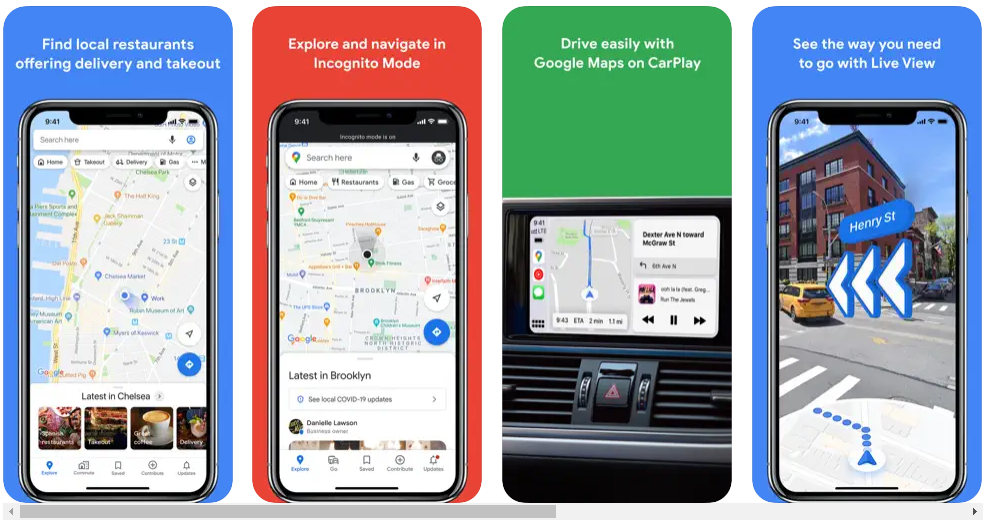
Google Maps is iPhone’s greatest navigation app. This free software provides real-time GPS, traffic, and transportation statistics. Google Maps has mapped 220 nations and territories and millions of places. You may discover takeaway, open businesses, and significant sites. Google Maps includes walking, driving, biking, flying, and public transit directions. You receive satellite photos and 360° surrounds. Real-time ETAs help you beat traffic. Live traffic statistics, road closures, and incidents help choose the optimal route. Google Maps’ turn-by-turn navigation is voice-guided. Google Maps includes offline navigation and interior maps for airports, malls, and stadiums.
Waze Navigation & Live Traffic
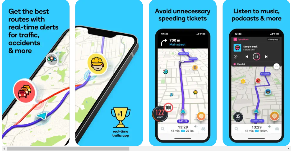
Waze is a traffic-focused navigation app. Google Maps uses its traffic management software. Waze is a popular community-based traffic navigation software where drivers share road data. Waze’s on-the-go maps require an internet connection to navigate and gather traffic updates. This app will warn you about accidents, road closures, police, and other traffic-related incidents in real time. This will help you avoid traffic. Waze finds the cheapest gas station on your route. Waze is one of the greatest iPhone navigation applications since it gives dependable and up-to-date information.
MapQuest GPS Navigation & Maps
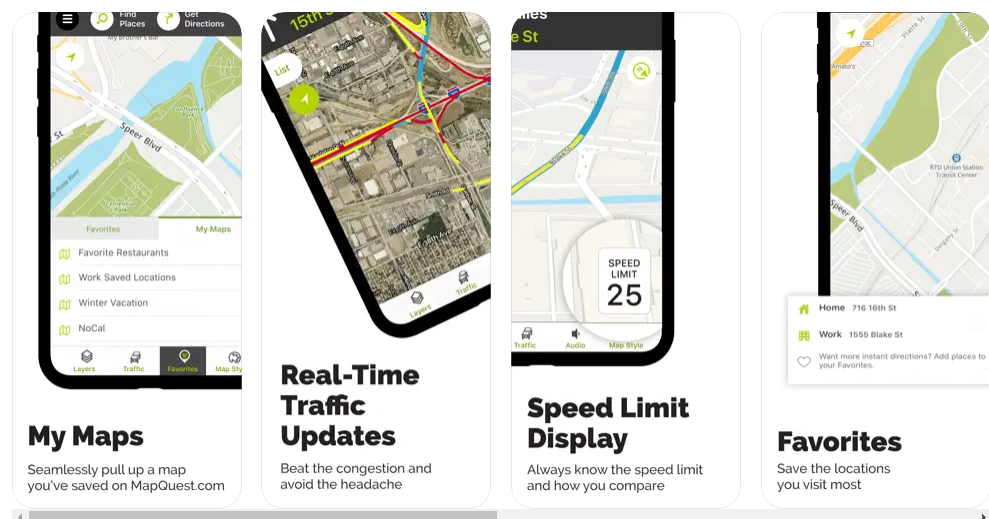
MapQuest has everything you need to explore the U.S. and Canada. You may use voice navigation for walking or driving directions or mapping. Apple CarPlay and live traffic camera are supported. Live satellite imagery and real-time traffic updates let you escape jams and find alternate routes. Its built-in speedometer compares your speed to stated speed restrictions. Multipoint itineraries allow for multi-stop travels. Use custom symbols to mark favoured locations. We utilise the layers bar to identify nearby eateries, cheap gas stations, etc. It’s one of the iPhone GPS navigation applications that allows you find and book hotels.
HERE WeGo Maps & Navigation
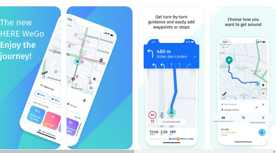
HERE is a free navigation app that can be downloaded on both iOS and Android devices. WeGo makes use of a GPS system optimised for urban navigation. Enjoy a stress-free trip to your destination as you easily navigate the city streets and take in the sights along the way. You may easily get there on foot with easy-to-follow stroll suggestions, use public transportation in more than 1,900 locations across the world, or enjoy voice assistance with turn-by-turn exact driving directions if you’re travelling by vehicle. Getting there couldn’t be simpler. By downloading a map of an area, nation, or continent before you need it, you may make it available without an online connection, which will save you mobile data and allow you to navigate without a connection to the internet.
SCOUTS
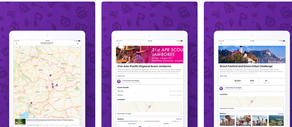
As its developers put it, Scout combines navigation with social networking. You may get real-time traffic and speed information, as well as turn-by-turn voice-guided navigation, using this app for the iPhone. Cafes, ATMs, motels, petrol stations, and other points of interest are all within easy reach thanks to your routes. Scout, in contrast to other iPhone navigation applications, has a group chat option. This feature may be used to coordinate a get-together, excursion, or road trip by allowing participants to exchange location data and monitor the progress of others toward their destination. Each user’s symbol and their friends’ icons will move together toward their goal when you use this app for navigation. In order to ascertain who would be tardy and who will arrive promptly.
MAPS.ME: Offline Maps, GPS Nav
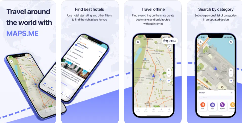
Are you seeking for a navigation software that can function without an active internet connection at all times and utilises far less of your battery life than other apps? Then you should check out the Maps.Me navigation and offline map app for the iPhone. You won’t need an internet connection to use this programme because it allows you to search for a place, navigate, and check up a number of different points of interest. This app’s maps are maintained and kept up to date by millions of users who contribute to OpenStreetMap. An open-source alternative to Google Maps and Apple Maps is available in the form of OpenStreetMap (OSM). On the other hand, some of the companies or areas of interest listed are not updated as regularly as others, which might occasionally irritate those who utilise the site.
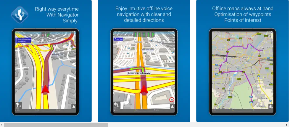
inRoute – Intelligent Routing
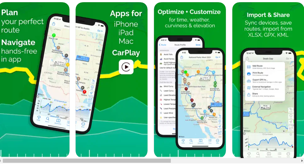
Using the smart travel planner tool known as inRoute, you can organise your journey by creating custom routes that include waypoints for many stops at once. This software provides features that you won’t typically find on other navigation applications for the iPhone, such as the ability to plan your route taking into account weather forecasts, the height of the road, and the curviness of the road. In addition to this, you are provided with navigational information on a turn-by-turn basis during severe weather. Despite this, this service is not offered anywhere outside of the EU, Canada, and the United States. This software does not give live traffic warnings, which is a feature that is often found in the majority of navigation applications. This is one of the most significant drawbacks of this app.
MapFactor Navigator – GPS Maps
This is a free GPS software that provides offline access to free maps provided by OpenStreetMaps. The application receives consistent updates in order to provide you with a superior experience as a user. You don’t need an internet connection to use this software because it works offline. It includes maps of more than 200 different nations. The software is less difficult to use because to its user-friendly UI. This application provides you with a number of helpful features, such as speed restrictions, audio turn-by-turn guidance, and camera alerts, among other things. In addition to that, it gives you the option of seeing visual maps in either 2D or 3D.
CoPilot GPS Navigation
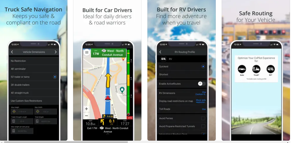
Different from the other navigation applications on this list for the iPhone, the CoPilot GPS app has a few unique features. It can plot navigational courses for a wide variety of vehicles, including SUVs, trucks, and recreational vehicles. Drivers in the delivery fleet and millions of other drivers across the world use the CoPilot app. This software has offline functionality and voice-guided navigation and route planning. Therefore, you may still safely navigate using their offline maps even if you lose cell service or your internet connection. Specialized navigational routes are provided for easy driving in large vehicles like trucks and RVs. Depending on the width of the road and the size of your vehicle, you will be given directions. Offline, CoPilot GPS may still provide you with access to a wealth of information on points of interest all around the world.
OsmAnd Maps Travel & Navigate
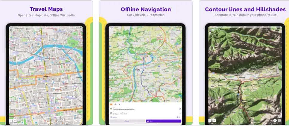
It is highly recommended that you download OsmAnd if you are seeking for a navigation tool that will provide you with globe maps. It is an OpenStreetMap-based programme that may be used offline. It gives you the ability to navigate based on the dimensions of your favourite car and the routes. Even if you do not have access to the internet, you will still be able to make route plans and record GPS tracks with the assistance of this software. It includes a reasonable map view as well as information on surrounding restaurants, sights, and other topics such as health. It offers navigation profiles that may be tailored to suit a variety of cars. You may also take use of the function that allows you to plan out and record your routes.
TomTom GO Navigation
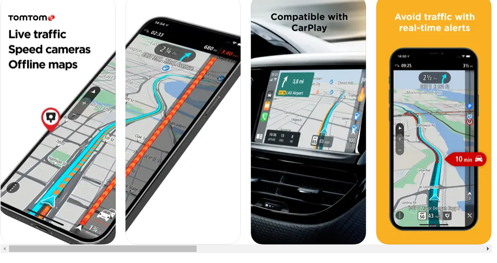
TomTom GO Navigation combines automotive navigation technology with traffic information. The software offers the fastest route based on real-time traffic data. TomTom Traffic tells you about delays and quicker routes. TomTom GO Navigation has lane guiding. Never miss a turn due to lane confusion. The software monitors posted speeds and notifies you to fixed and mobile speed cameras (requires an internet connection). Plan a route offline when you don’t have internet or data roaming. The app has preset attractions. Quick Search discovers destinations as you type. You may also paste URLs from websites or applications into Quick Search. Or, tap your chosen place on the map.
Gaia GPS: Mobile Trail Maps
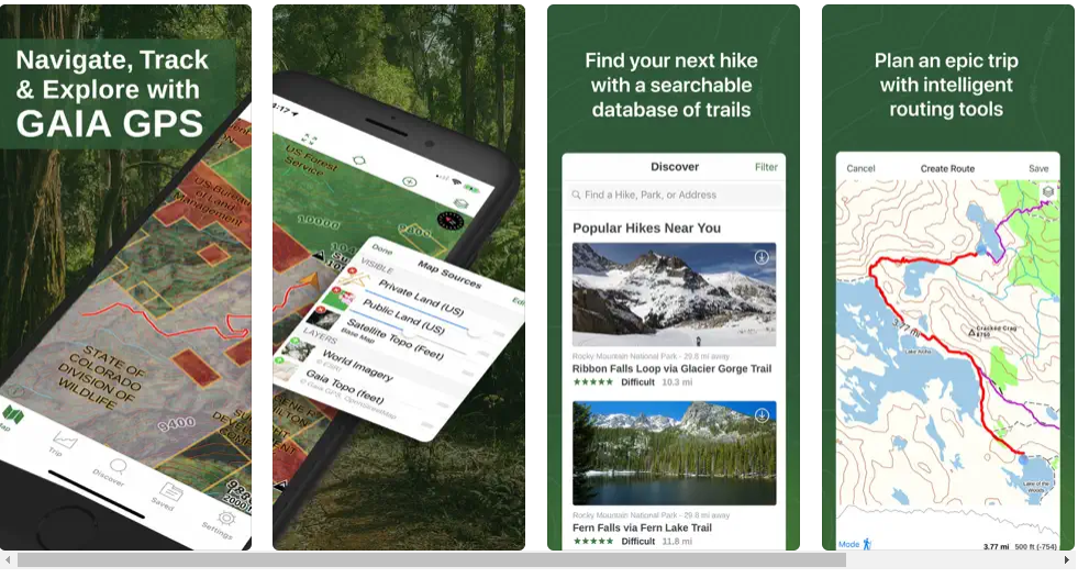
Gaia GPS began as a hiking software, but it has now extended to include many kinds of outdoor leisure activities. Gaia may be tailored to your hobbies, whether you enjoy mountain biking, hiking, hunting, skiing, or camping. Use the app’s Discover option to look up treks and local trails wherever you are. Hunters may discriminate between public and private territory using state-by-state hunting data, and bikers can strap Gaia GPS to the handlebars for hands-free navigation. With Gaia GPS, skiers can locate powder and stay out of avalanche terrain. Because of how reliable this software is, search and rescue teams, land managers, and firemen all utilize it.
Karta GPS – Maps & CarPlay
The Karta GPS app for iPhone is a respectable offline navigation application. The GPS turn-by-turn navigations are carried out with the help of the OpenStreetMap (OSM) maps. Additionally, it offers real-time traffic information; however, this function is only available in some countries. This app provides voice-guided navigations and contains millions of sites of interest all in one convenient location. When driving on highways, Karta GPS also provides alerts for excessive speeding, in addition to lane guidance help. On the other hand, there are rumours that Karta does not disclose other traffic-related dangers, such as road closures or construction.
Roadtrippers – Trip Planner
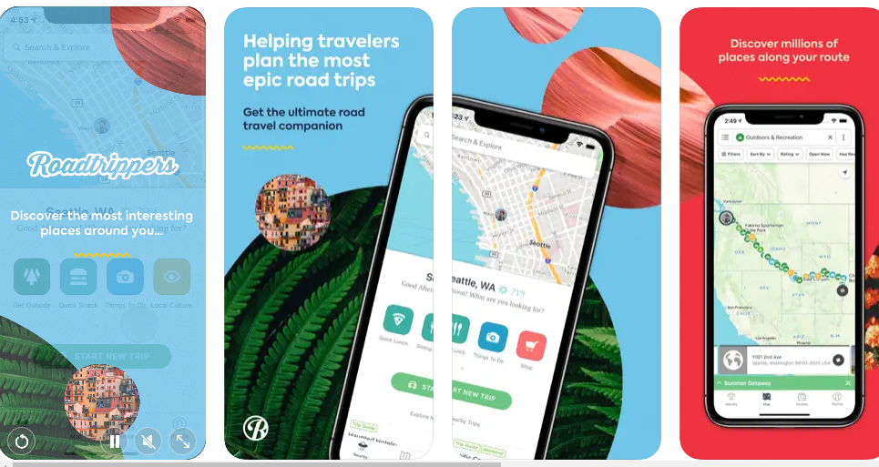
Roadtrippers is the greatest trip planning software available, so give it a try if you want to organise the ideal vacation for you and your loved ones to go on the open road. You will be able to plan a road trip using this software that includes a number of waypoints in between, allowing you to stop at numerous new destinations along the way. You will be provided with a navigation guide that details each turn along the path you have specified. During your trip, you will be given recommendations to dine at a neighbourhood restaurant, stop at some roadside sites, or stay in an excellent hotel. Unfortunately, whether you live in the United States of America, Canada, New Zealand, or Australia, this incredible map includes information on road journeys.
Sygic GPS Navigation & Maps
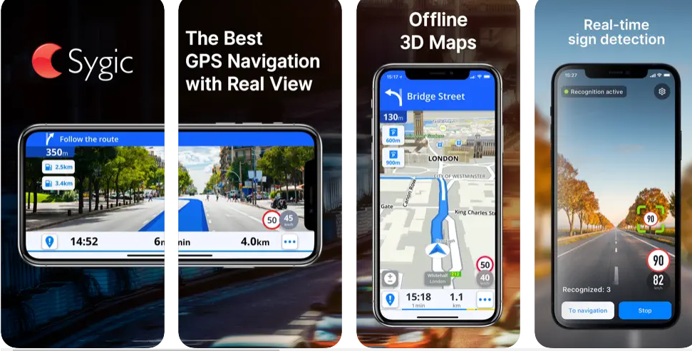
Our next recommendation is Sygic GPS Navigation & Maps, which has been downloaded over 200 million times. Sygic’s ability to provide offline navigation and maps is a major selling point. Get this programme, and you may use either a 2D navigational view or a 3D offline map of the planet. Its voice-guided navigation instructions and directions to major tourist destinations or millions of other intriguing places are available in several languages, making it ideal for trip planning and tourism. Sygic also provides live traffic reports and parking guidance based on data from millions of users. Moreover, they inform one another of the locations of speed cameras to avoid receiving citations and of gas stations together with the pricing of the gasoline they sell.
ETA – GPS & maps driving times
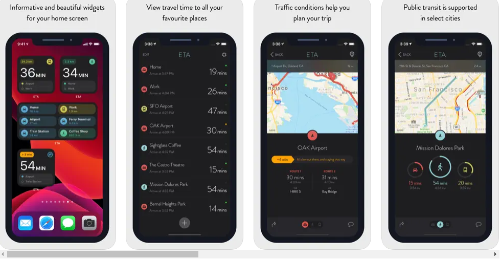
Whether you like to drive, take public transportation, ride a bike, or walk, ETA will promptly display the trip time to your preferred destinations. Traffic information detailing potential holdups along your route is another useful feature offered by ETA when travelling. With our carefully crafted iOS Home Screen widgets, you’ll always know what’s going on with your commute, no matter where you are. The widget will pull up your scheduled events and tell you when you need to depart in order to make it on time. Our widgets on the Home Screen are updated throughout the day at set intervals per Apple’s recommendations. Apple Watch users may depend on ETA to provide accurate travel time on their wrist. Whether you’re using a vehicle, bike, bus, or just walking, ETA will keep track of your location and update your trip time in real time. As per Apple’s standards, ETA refreshes its watch face with the most up-to-date information every 15 minutes.
Conclusion
For safe navigation and arrival at your destination, the top GPS navigation applications offer the most precise position data, real-time traffic updates, and street views. However, there are more uses for mapping applications outside merely travel planning.
With the use of AI and machine learning, these GPS applications provide extra capabilities that streamline route planning and navigation. They provide updates on neighbouring gas stations, assist you in navigating congested regions and inclement weather, and more.
The list of top GPS navigation apps presented in this article will be useful to you whether you’re seeking for the best map app for Android or the best navigation app for iPhone.